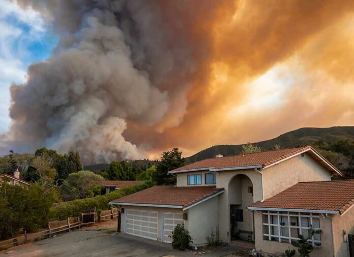
When a wind-driven wildfire pushes into populated terrain, the decisive act is not containment but choreography: moving people out of harm’s way as the fire’s behavior changes by the hour. The Hawk Fire in and around Reno showed what that looks like when it works at scale—graded evacuation orders, a unified emergency posture, and messaging calibrated to a fast, unpredictable threat.
The Short Version
- Nevada’s governor declared a state of emergency as the Hawk Fire spread rapidly toward neighborhoods, triggering a large, multi-agency response.
- Roughly 42,000 residents were ordered to evacuate at one point, with an additional 45,000 advised to be ready to leave; counts shifted as the incident evolved.
- Authorities stood up infrastructure fast: a primary evacuation center, road controls, and clear guidance to prepare “go bags” and evacuate early when directed.
What officials did, and why it mattered
State leadership moved early and publicly. Governor Joe Lombardo issued an emergency declaration specific to the Hawk Fire’s advance on Washoe County communities, signaling a posture that unlocks resources, accelerates interagency coordination, and tells local managers that life safety drives every downstream decision. His message was unambiguous: heed local warnings and evacuate when ordered. That clarity matters in a wind event; minutes can be the difference between a well-timed departure and gridlock inside a smoke column.
Local incident managers matched that posture with a graded evacuation strategy. Instead of treating the metro edge as a monolith, they carved the footprint into zones with distinct instructions—mandatory in some areas, warnings in others—anchored to neighborhoods and transportation corridors people actually navigate: Somersett and Verdi, the North Valleys and Cold Springs, Golden Valley and Lemmon Valley, and the US 395/Red Rock Road axis. That granularity does two things. It directs limited law-enforcement and fire resources to the places with the highest risk, and it preserves mobility for those outside the most acute threat so road networks stay functional for the people who must go now.
How a wind-driven fire changes the playbook
Wildfire managers deal in probabilities, not guarantees. In a wind event, the variables that matter—speed, direction, ember cast, and fuel continuity—can reorganize the map faster than static orders can keep up. The Hawk Fire was repeatedly described as wind-driven and “very dynamic,” a phrase incident commanders use sparingly because it implies operational complexity: spot fires ahead of the main front, lateral runs into drainages, and sudden reversals when gusts shift downslope. Under those conditions, policy shifts from precision suppression to life safety and structure defense; the order of operations is protect people first, then anchor, flank, and pinch the fire when the weather gives you an opening.
Because smoke and wind degrade situational awareness—both for the public and for responders—messaging tightens. Truckee Meadows Fire Chief Richard Edwards advised residents to have go bags ready, a signal that conditions can escalate from warning to order without a long preamble. Evacuation counts moved accordingly as the footprint evolved; at one point, officials reported approximately 42,000 under mandatory orders and another 45,000 in warning zones, with other snapshots citing “thousands of homes” and “tens of thousands urged to flee,” all consistent with a living incident rather than a static disaster.
Infrastructure for leaving well: shelters, routes, and resource flow
Evacuations are logistics problems before they are public-safety triumphs. Washoe County and partner agencies designated the Reno-Sparks Convention Center as an evacuation hub—big halls, easy ingress and egress, and capacity for scaling medical and social services as the night wears on. Transportation managers synchronized closures and lane guidance with the fire’s advance, particularly along US 395 and Red Rock Road, to keep departures moving and engines flowing toward structure-defense assignments. On the operations side, reporting across the incident window described a surge of personnel—hundreds to roughly a thousand firefighters at peak—with state and federal teams reinforced by California aircraft, a familiar pattern when a Nevada front pushes up against the Sierra crest and aviation bases to the west can turn sorties faster.
Power outages and facility closures are not footnotes; they shape the hazard. Energy utilities executed de-energizations and emergency response to wind and fire impacts, and a North Valleys emergency department temporarily closed during one operational period—moves that eliminate ignition sources and maintain safety, even as they complicate life for evacuees and responders. The net effect is to strip friction from the main task: get people clear of the fire’s plausible run paths, then hold the line when the wind abates.
What the zone names mean to the people living there
One reason confusion persists in wildfire seasons is that “evacuation” is not a single instruction. A warning means there is a credible threat; you should prepare to leave, load your car, and check on neighbors who need help. An order means leave now—do not wait to confirm with social media, do not linger for keepsakes, and do not drive back into a zone you just exited. During the Hawk Fire, the practical expression of that distinction was geographic: neighborhoods north and northwest of Somersett, sections north of Verdi, and the North Valleys/Cold Springs axis alternated between warnings and orders as the fire moved and winds shifted. For residents, the actionable takeaway is simple: if you live along US 395’s northern arc or in the foothills below Peavine when a wind event spins up, you are in a zone where warnings can become orders before the six o’clock news finishes its A-block.
Expert guidance aligns with this cadence. National evacuation planning frameworks and public-health literature emphasize predefined triggers—fire proximity, wind changes, visibility, and particulate (PM2.5) exposure—because those metrics correlate with both burn probability and smoke injury risk, especially for older adults and people with cardiopulmonary disease. When winds drive a front into suburbs, the calculus favors early movement; a full parking lot at the shelter is easier to manage than a late-stage jam at the last on-ramp.
12 PM Bottom-of-the-Hour News
President Trump just fired another shot in the growing trade war with Canada. He posted on Truth Social that tariffs on all cars and trucks, automotive parts and steel will be increased to 50 percent starting January first.
Canada is planning… pic.twitter.com/99NUNGuN2D— Worldwide News Network (@WorldwideNNX) August 24, 2026
The pictures on your phone versus the map on your wall
In every major Western fire, dramatic video outruns careful maps. Eyewitness footage from Reno—smoke veils over US 395, flame edges flickering above cul-de-sacs—conveys urgency but can compress time and space; a long-lens shot of a ridgeline can look like a subdivision. The incident record tells the steadier story: a governor’s order, a county’s zone-by-zone directives, a chief’s instruction to pack now, and an evacuation center that opened and filled on cue. That is not the absence of drama; it is the presence of discipline. The signal for households is to let the official map, not the algorithm, govern your movements.
What to remember for the next red flag day
Three habits save lives in this corridor. First, know your zone—by name and by boundary—before fire weather arrives; if you can sketch your evacuation route on a napkin, you will move faster when the alert pings. Second, pre-stage a go bag that matches your household’s realities: prescriptions, documents, chargers, pet supplies, and enough clothing to operate independently for 72 hours. Third, translate warnings into action, not anxiety; top off the car, call the neighbor who cannot drive, and leave when the order lands rather than when the flames are visible from your porch. Those choices free firefighters to do the job only they can do when a wind-driven front turns toward homes.
Sources:
emergencywashoe.com, 2news.com, lovingreno.com
© featurednews.com 2026. All rights reserved.